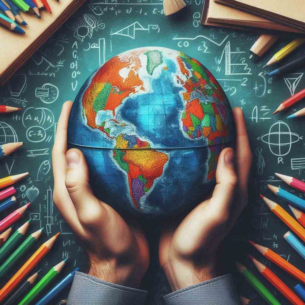
Educational Globes: The World at Your Fingertips
Imagine holding the entire world in your hands—where you can trace your fingers across continents, oceans, and countries in just a few seconds. Educational globes provide just that: a visual and interactive way to learn about our planet. They are much more than a simple ball of the Earth; these globes are powerful tools used to enhance learning and understanding of global geography, cultures, and even political boundaries.
| Fact | Details |
|---|---|
| First Terrestrial Globe | Created by Crates of Mallus around 150 BC |
| Most Common Type of Globe | Political globes, focusing on countries and borders |
| Typical Diameter of Classroom Globes | 12 inches (30.5 cm) |
| Largest Globe | “Eartha,” located in Yarmouth, Maine, USA, with a diameter of 41 feet (12.5 meters) |
| First Interactive Globe | Introduced in the early 21st century with touch and AR features |
| Common Globe Materials | Plastic, metal, or cardboard |
| Estimated Market Growth for Educational Globes | Expected to grow by 5% annually by 2027 |
| Popular Use in Classrooms | To teach geography, political divisions, and Earth’s features |
| Augmented Reality (AR) Globes | Use apps to display additional data, videos, or live updates |
| Global Adoption Rate | Used in over 80% of classrooms globally for geography lessons |
| Digital Globe Market | Worth approximately $2 billion in 2023, growing rapidly |
| Top Globe Manufacturers | Replogle Globes, Zoffoli Globes, National Geographic Globes |
| Most Common Educational Uses | Geographical visualization, understanding time zones, climate, and cultural exploration |
| Average Lifespan of Classroom Globes | 5 to 10 years, depending on material and usage |
| Popular Globe Add-ons | Built-in LED lights, augmented reality apps, interactive touch features |
The Evolution of Educational Globes

From Ancient Times to Modern Learning
The concept of globes has been around for centuries, with the first known terrestrial globe created by Greek astronomer Crates of Mallus around 150 BC. In those early days, globes were rare, hand-crafted items, reserved for scholars and wealthy individuals. As time passed, globes became more accessible and found their way into educational settings, providing students with a hands-on tool to visualize the Earth in a three-dimensional form.
The Rise of Globes in Classroom Education
During the 18th and 19th centuries, globes became increasingly common in classrooms. They replaced flat maps as the go-to resource for geography education, helping students better grasp the concept of Earth’s spherical shape and understand global relationships. Today, globes are found in many classrooms worldwide, with new interactive and technological features transforming the way we use them.
Types of Educational Globes

Physical Globes
A physical globe focuses on the natural features of the Earth, including mountains, valleys, rivers, and oceans. These globes are perfect for teaching physical geography and helping students understand the Earth’s diverse landscapes.
Political Globes
Political globes, on the other hand, emphasize human-made boundaries like countries, states, and cities. They provide students with an understanding of the world’s political divisions, showing where different nations are located and how they are governed.
Interactive and Digital Globes
Thanks to technological advancements, interactive globes are becoming a popular choice in education. These globes incorporate digital features like touchscreens and augmented reality (AR) to provide a more engaging learning experience. With AR-enabled globes, students can scan the globe using a device, and extra layers of information will appear, such as facts about countries or even live weather updates.
Why Educational Globes Are Important in Learning
Enhancing Geographical Knowledge
One of the most significant benefits of using educational globes is that they help students develop a better understanding of geography. By seeing the world in a three-dimensional form, learners can grasp concepts such as distance, location, and global positioning more effectively than they would from a flat map.
Sparking Curiosity and Critical Thinking
Globes don’t just show where things are—they also spark curiosity. A child might start asking questions like, “Why is it cold at the poles?” or “How long would it take to travel from Africa to South America?” These types of questions encourage critical thinking and foster a deeper understanding of the world.
How Educational Globes Aid in Understanding Global Concepts
Visualizing Physical Features
One of the challenges of teaching geography is helping students visualize physical landscapes like mountains and rivers. A globe makes this easier by giving a real-world view of the Earth’s features. Students can easily identify where the world’s major landforms and water bodies are located.
Learning About Continents, Countries, and Capitals
With a political globe, students can learn about the various continents, countries, and their capitals. They can also study the relationships between different nations and how borders have evolved over time. Globes make it simple to visualize the relative sizes of countries and continents, giving learners a more accurate understanding of the world map.
Using Globes in Various Educational Settings
Classroom Use
In classrooms, globes are often used to supplement geography lessons. Teachers may use a globe to demonstrate the Earth’s rotation, explain time zones, or discuss current global events. It’s a versatile tool that complements textbooks and other visual aids.
Homeschooling Benefits
For homeschoolers, globes can be an engaging way to make geography lessons more interactive. They allow children to explore the world from their own home, making learning more hands-on and exciting.
Museum and Exhibition Learning
Educational globes also appear in museums and exhibitions, where they help illustrate global topics, from environmental changes to ancient exploration routes. Globes used in these settings often include additional information on historical events and global issues.
Incorporating Technology into Modern Globes
Augmented Reality Globes
One of the latest trends in educational globes is the use of augmented reality (AR). By pairing a globe with an app, students can scan various parts of the globe and instantly see relevant data, videos, or interactive maps. This is an excellent way to engage tech-savvy learners who are already comfortable with digital platforms.
Interactive Features for Enhanced Learning
Some modern globes come equipped with built-in audio guides or touchscreen panels that allow students to interact with the globe directly. These features often provide quizzes, games, and fun facts that make learning geography a more enjoyable experience.
Choosing the Right Educational Globe
Age-Appropriate Globes for Children
When selecting an educational globe, it’s important to consider the age of the learner. Younger children might benefit from simplified globes with bright colors and large labels, while older students may need more detailed globes that show political boundaries or topographic features.
Advanced Globes for Older Students and Adults
For high school students or adults, an advanced globe that includes detailed political or physical information is ideal. Some globes also come with educational software or are linked to online resources that provide up-to-date global information.
Fun Activities to Do with Educational Globes
Globe Quizzes and Games
There are many fun ways to use a globe in an educational setting. For example, you can turn it into a game by having students spin the globe, point to a random location, and then identify the country or continent they landed on. It’s a fun, interactive way to test geographical knowledge.
Exploring Cultures and History
Globes also make a great starting point for exploring different cultures and historical events. You can use the globe to trace the paths of explorers, study migration patterns, or learn about world religions and their spread across continents.
The Future of Educational Globes
Advancements in Interactive Technology
The future of educational globes is looking brighter than ever with advancements in technology. We’re seeing the rise of interactive features, AR, and even virtual reality globes that allow students to experience the world in new and exciting ways.
Virtual Reality and 3D Mapping
Virtual reality (VR) globes are another exciting development, offering students the chance to “step inside” the globe and explore it from a first-person perspective. This immersive experience helps bring geography lessons to life, making them more impactful.
Conclusion
Educational globes are timeless tools that continue to play a crucial role in learning about the world. Whether physical, political, or interactive, globes help students visualize and understand the complexities of our planet in ways that flat maps cannot. As technology advances, we can only expect educational globes to become even more engaging and informative, fostering a deeper connection with the world around us.
FAQs About Educational Globes
- What is the purpose of an educational globe?
Educational globes help learners understand geography, visualize the Earth’s physical features, and explore countries, capitals, and political boundaries. - How do interactive globes work?
Interactive globes often feature touchscreens, audio guides, or augmented reality apps that provide additional information when students interact with the globe. - Are educational globes suitable for all ages?
Yes, globes are available in various formats to suit all ages, from simple globes for young children to advanced globes for high school students and adults. - What is the difference between a physical and political globe?
A physical globe shows the Earth’s natural features like mountains and rivers, while a political globe focuses on human-made boundaries like countries and cities. - Can globes teach more than geography?
Yes, globes can be used to teach history, culture, environmental science, and even economics by exploring trade routes, migration, and global resources. - What are augmented reality globes?
Augmented reality globes pair with an app that allows users to scan the globe and view additional information, making learning more interactive and engaging. - How do educational globes differ from maps?
Globes provide a three-dimensional view of the Earth, offering a more accurate representation of distance and scale compared to flat maps. - Can I use an educational globe for homeschooling?
Absolutely! Globes are a fantastic tool for homeschooling, making geography lessons more interactive and visually engaging. - Are there digital globes available?
Yes, there are digital globes that can be accessed online or through apps, offering interactive features and up-to-date information. - What is the future of educational globes?
The future of educational globes includes advancements in technology such as virtual reality and augmented reality, making geography education even more immersive.